Save, Protect and Rezone Tootgarook Swamp on the Mornington Peninsula

As the world prepares to celebrate World Wetland Day 2015 in February, the Tootgarook Swamp is facing a very uncertain future – as a housing development! It this how our State government’s version of wetland “conservation”? Housing will see it gone forever!
AWPC wishes to object to the Planning Applications P14/1202 and P14/1901 at 92 Elizabeth Avenue on the following grounds,
In our opinion the Planning application does not meet the requirements of Section 12, of the Mornington Peninsula Planning Scheme which states,
ENVIRONMENTAL AND LANDSCAPE VALUES
Tootgarook swamp is the home of a vast number of animals including 129 bird species, 13 reptillian species, 12 mammals and 9 amphibious frog species (recorded to date). Due to the lack of proper studies, this number would no doubt increase.
Tootgarook Swamp was once the largest landmark on the southern end of the peninsula stretching almost the whole length between the bay and the ocean. The wetland is made of a special peat soil and used to be home to hundreds of species of native fauna, many now extinct in the area.
It is home to over 120 different bird species, some of which are endangered or threatened. Many are migratory and travel thousands of kilometres to the area to use breeding site and produce new generations of birds.
The Swamp contains many indigenous flora species which no longer readily occur on the peninsula.
A lot of the Tootgarook swamp is zoned as residential and industrial and even worse is the fact that there are development proposals for approximately 80 hectares of it. This makes up almost a quarter of the swamp!
Currently approximately 77 hectares is marked for future development proposals totalling almost a quarter of the entire swamp. After another almost 3 hectares was lost to a housing subdivision infill recently.
Rezoning parts of Tootgarook Swamp for housing development should be rejected.
-Planning should help to protect the health of ecological systems and the biodiversity they support (including ecosystems, habitats, species and genetic diversity) and conserve areas with identified environmental and landscape values.
-Planning must implement environmental principles for ecologically sustainable development that have been established by international and national agreements. The word “sustainable” far too generic and over-used, and should be replace by the word “stewardship” of ecological and environmental systems, and this “development” is nothing short of a mockery of it!
-Planning should protect sites and features of nature conservation, biodiversity, geological or landscape value. How can digging up Tootgaroot Swamp protect any ecological features? Housing is NOT endangered in Victoria, and our real estate Ponzi pyramid is camouflaging our economy’s weaknesses. We should be promoting real economic prowess, productivity and innovation, not dead-end and destructive housing growth! The more houses that are built, the more our population will increase – not the converse!
-The application not only fail to address these sections of the State Planning Policy Framework, but completely contradict it.
-It seems that extremely minimal regard has been applied to the sites ecosystem, habitat, species, biodiversity and environmental values. The fact that it makes up an important part of environmental habitat and connectivity of the Tootgarook Swamp which it is part of, landscape value and ecosystem in terms of hunting grounds, breeding grounds, food sources and wildlife refugia during and outside inundation events has not been addressed, nor does the planning application try to conserve any part of these values. It seems that any wildlife, or habitat, or biodiversity loss is no more than collateral damage, and a mere obstruction to housing profits.
-The Tootgarook Swamp is a key natural feature of the Nepean Peninsula being only one of two natural depressions where fresh groundwater is at the surface, the other being Portsea lagoon.
-The proposed A 99 Planning development site was home to what was classified as state significant vegetation, before being modified and sown with rye grass in 2008.
-Mapping surveys carried out in 2003 by DEPI’s Arthur Rylah Institute in conjunction with the shire council and in 2006 by Practical Ecology have record of the default values of the site and should set the bench mark for appropriate offsets being made. Considering the applicants disregard for the site from 2008, the Council should not be undertaking the method of rewarding developers with permits for land that have been destroyed, or degraded by the developers.
A firm stance should be taken by this shire in order to prevent landholders and developers benefiting from illegal clearing no matter the reason or excuse, as ultimately this reduces the required number of offsets for a site, thus increasing their profitability and can be viewed as a form of fraud.
Significant fauna species that have been recorded within the site and surrounding reserves include:
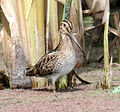
Latham’s Snipe, (above)
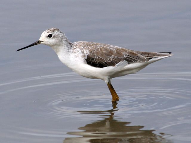
Marsh Sandpiper,(above)
Eastern Great Egret (above)
Little Egret,
Intermediate Egret,
White footed dunnart,
Swamp Skink (above)
Lewin’s Rail,
Glossy Grass Skink,
Australian Shoveler,

Freckled Duck, (above)
Nankeen Night Heron,

Pacific Gull (above).
The Australasian Bittern an EPBC listed and had been frequently observed and photographed on the applicant’s site this year. With the EPBC migratory (CAMBA, JAMBA, ROKAMBA and Bonn) species Latham’s Snipe, Sharp Tailed Sandpiper, Common Greenshank, and Marsh Sandpiper have been seen utilising the very front of the site.
This also does not include a large list of fauna that is of regional and local significance or uncommon.
As the proposals are situated within an area of high biodiversity value the proposals infill, design, and sitting of buildings fails to minimise the removal and fragmentation of native vegetation.
The greater Tootgarook swamp has been mapped by DEPI (Department of Environment and Primary Industries) as possibly containing Acid Sulphate Soils which could pose a serious problem if disturbed, both to the development and to the adjacent Sanctuary Park Bushland Reserve and Chinamans Creek Reserve as well culvert infrastructure. The boundary soils will be disturbed by any possible retaining wall construction or by heavy machinery used to batter and fill under this proposal.
Please send objection to:
A 99 LOT SUBDIVISION APPLICATION ON TOP OF A LARGE PORTION OF THE TOOTGAROOK SWAMP.
planning.submission@mornpen.vic.gov.au
Mornington Peninsula Shire,
Statutory Planning Department
Private Bag 1000
Rosebud, 3939.
This is not a “development” proposal, but is asking for a permit to vandalize an ecological feature, and biological reserve with destruction.
CommunityRun Petition:Save, Protect and Rezone Tootgarook Swamp on the Mornington Peninsula
Visit the website SaveTootgarookSwamp
(featured image: Marsh Sandpiper)


